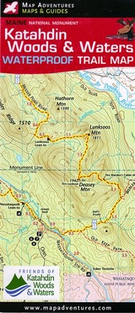
Katahdin Woods & Waters National Monument Waterproof Trail Map
Tech Specs
Specifications are maintained on Pack4Back GearDB (community edits and revision history). Values may differ from the manufacturer or your unit—verify before buying.
BrandMap Adventures
Best UseHiking
Folded Dimensions9 x 4 x 0.5 inches
Unfolded Dimensions24 x 27 inches
Map Scale1:40,000
Double SidedYes
WaterproofYes
PublisherMap Adventures
Copyright Year2019
State / ProvinceMaine
Description
Hike, bike, paddle and experience the history and culture of Maine's Northern Penobscot County with the Map Adventures Katahdin Woods & Waters National Monument waterproof trail map.
Features
- Contains detail description of hiking and cycling trails, designated hunting areas, and canoe and kayak put-ins
- Includes the Maine section of the International Appalachian Trail (IAT), the 138.4 mi. long Dick Anderson Trail
- Also includes suggestions for day trips, an index of all trails, UTM/GIS grid, 40 ft. contour lines and trail points with mileage noted
- This waterproof, tear-resistant recreation map is printed on both sides