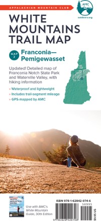
White Mountains Trail Map: Franconia - Pemigewasset
Tech Specs
Specifications are maintained on Pack4Back GearDB (community edits and revision history). Values may differ from the manufacturer or your unit—verify before buying.
BrandAMC
Best UseHiking
State / ProvinceNew Hampshire
Folded Dimensions9 x 4 x 0.16 inches
Double SidedYes
WaterproofYes
PublisherAppalachian Mountain Club Books
Copyright Year2017
Map Number2
Description
Find your way through Franconia Notch State Park and Pemigewasset Wilderness Area of White Mountain National Forest with the completely waterproof AMC White Mountains trail map 2.
Features
- Map 2 covers Franconia Notch State Park, Waterville Valley, the Pemigewasset Wilderness Area and the popular Kancamagus Highway of White Mountain National Forest
- Updated, full-color double-sided map printed on waterproof material
- Includes trail-segment mileage