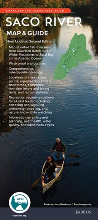
Saco River Map & Guide
Tech Specs
Specifications are maintained on Pack4Back GearDB (community edits and revision history). Values may differ from the manufacturer or your unit—verify before buying.
BrandAMC
Best UsePaddling
State / ProvinceMaine
Folded Dimensions9 x 4 x 0.32 inches
Unfolded DimensionsUnavailable
Map ScaleUnavailable
Double SidedYes
WaterproofYes
PublisherAppalachian Mountain Club Books
Copyright Year2019
Description
From Crawford Notch in the White mountains to Saco Bay in the Atlantic Ocean, the Saco River flows through some of the most scenic land in the Northeast. This map and guide charts the 136-mile course.
Features
- Flowing across eastern New Hampshire and southern Maine, this longtime canoe and kayak destination river also offers tubing, swimming, whitewater paddling, fishing and camping
- Mile-by-mile breakdown with river access points, equipment outfitters, boat ramps, campgrounds, riverside hiking and biking trails, and ranger stations all identified on-map
- Also includes dams and areas of intermediate to advanced whitewater action
- In addition to recreation recommendations and planning information, it foregrounds river health, water quality and wilderness ethics for better care of this natural resource
- Waterproof and tear-resistant, the Saco River Map & Guide is a quintessential before-you-go planning tool and an invaluable companion once you're on the water