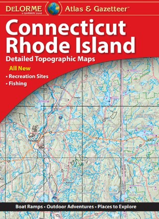
Connecticut and Rhode Island Atlas and Gazetteer
Tech Specs
Specifications are maintained on Pack4Back GearDB (community edits and revision history). Values may differ from the manufacturer or your unit—verify before buying.
BrandDeLorme
Best UseTravel
State / ProvinceConnecticut
Folded Dimensions15.5 x 11 x 1 inches
Unfolded Dimensions22.3 x 15.5 x 1 inches
Map Scale1:200,000
Double SidedYes
PublisherGarmin
Copyright Year2020
Description
The amazingly detailed, large-format DeLorme Connecticut and Rhode Island Atlas and Gazetteer is the perfect companion for sightseeing, exploring back roads, outdoor recreation and trip planning.
Features
- With a total of 60 map pages, the Atlas and Gazetteer is your most comprehensive navigational guide to the backcountry of Connecticut and Rhode Island
- Full-color topographic maps provide info on everything from cities and towns to historic sites, scenic drives, recreation areas, trailheads, boat ramps and prime fishing spots
- While available information varies by state, DeLorme maps generally provide information essential for any outdoor enthusiast
- Includes info on points of interest, landmarks, state and national parks, campgrounds, boat launches, golf courses, historic sites, hunting zones, canoe trips, and more
- Topographic maps have elevation contours, major highways and roads, dirt roads, trails, and land-use data
- Handy latitude/longitude overlay grid for each map allows you to navigate with GPS
- Inset maps provided for major cities as well as all state lands