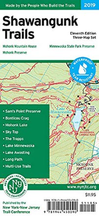
Shawangunk Trails Map Set - 11th Edition
Tech Specs
Specifications are maintained on Pack4Back GearDB (community edits and revision history). Values may differ from the manufacturer or your unit—verify before buying.
Best UseHiking
State / ProvinceNew York
Folded Dimensions8 x 4.5 x 0.5 inches
Unfolded Dimensions21.5 x 20 inches
Map Scale1:30,000
Double SidedYes
WaterproofYes
PublisherNY/NJ TC
Copyright Year2019
Description
With 3 maps detailing more than 200 mi. of maintained trails and carriage roads, the 11th edition of the Shawangunk Trails map set is a must-have for exploring the special features of the region.
Features
- Set includes maps 104, 105 and 106A/106B
- Printed on waterproof, tear-resistant Tyvek® material for exceptional durability
- 2019 edition includes trail mileages, newly-preserved lands, changes to the roads and trails near the Minnewaska park entrance, and the addition of several viewpoints
- Features more than 200 mi. of maintained trails and carriage roads—many of which are open to bikes and horses—in the northern Shawangunks of Ulster County
- Featured trails include sections of the Long Path and Shawangunk Ridge Trail between Wurtsboro and Route 52
- New trails include the Stony Kill Falls Trail and the River-to-Ridge Trail
- An enlarged large-scale map shows the complex trail network in the area of Mohonk Mountain House
- Parklands in the coverage area include Minnewaska State Park Preserve, Mohonk Preserve, Shawangunk Ridge State Forest, and the Mohonk Mountain House property
- 20 ft. elevation contours; UTM coordinate grid
- Scale of 1:30,000 (1 in. = 0.47 mi.)
- Maps indicate parkland boundaries, unmaintained trails, woods roads and parking areas
- Maps also indicate viewpoints, mines, waterfalls and other points of interest, as well as park contact information, history and regulations