
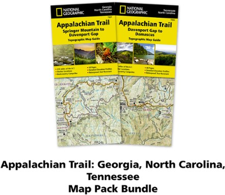
Appalachian Trail Map Pack: Georgia, North Carolina and Tennessee
Tech Specs
Les fiches techniques sont tenues sur Pack4Back GearDB (communauté et historique des versions). Des écarts avec le fabricant ou ton matériel sont possibles.
BrandNational Geographic
Best UseBackpacking
Folded Dimensions23.5 × 10.8 × 0.8 cm
Map Scale1:63,360
Double SidedYes
WaterproofYes
PublisherNational Geographic
Copyright Year2020
State / ProvinceGeorgia
Map Number1501
Description
This Appalachian Trail map pack covers Georgia, North Carolina and Tennessee, tracing the trail from its southern terminus at Springer Mountain to Damascus on the Tennessee/Virginia state line.
Points clés
- The southernmost section of the AT offers some of the trail's most challenging and rewarding hiking, including more than 70 miles through Great Smoky Mountains National Park
- Pack includes 2 detailed topographic map guide booklets centered on the Appalachian Trail (AT) and overlapping with adjacent sections to reduce your chances of getting lost
- Built for all levels of hiking enthusiasts—from day-tripper to thru-hiker—these Topographic Map Guides are more convenient and easier to use than folded maps
- Front pages include resupply information, town inset maps, camping options and much more
- Printed on "Backcountry Tough" waterproof, tear-resistant paper with stainless-steel staples
- Along the bottom of each page, a trail profile shows distances between shelters, camping areas and trail access points
- Map and trail profile provide a step-by-step visual guide to hiking the trail, mile by rugged mile
- A full UTM grid is printed on the map to aid with digital navigation
- Your purchase helps support National Geographic Society nonprofit's mission of research, education, conservation and exploration
- 1:63,360 scale means 1 in. equals 1 mile