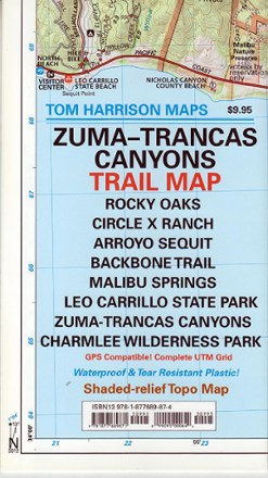
Zuma-Trancas Canyon Trail Map
Tech Specs
Les fiches techniques sont tenues sur Pack4Back GearDB (communauté et historique des versions). Des écarts avec le fabricant ou ton matériel sont possibles.
Best UseHiking
Folded Dimensions20.3 × 11.4 × 0.5 cm
Unfolded Dimensions61.0 × 45.7 cm
Map Scale1:31,680
Double SidedYes
WaterproofYes
PublisherTom Harrison Cartography
Copyright Year2012
State / ProvinceCalifornia
Description
Explore the high mountain vistas and rugged canyons above Malibu with the Tom Harrison Cartography Zuma–Trancas Canyons trail map, filled with color-coded trails and shade-contoured elevation gains.
Points clés
- Covers Rocky Oaks, Circle X Ranch, Arroyo Sequit, Backbone Trail, Malibu Springs, Leo Carrillo State Park, Zuma and Trancas Canyons, and Charlee Wilderness Park
- Features color-coded symbols and trails, trail mileage between junctions, latitude/longitude, UTM grids, contour lines, vegetation and elevation indicators
- 1:31,680 scale with 50 ft. elevation contours