
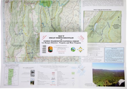
Map F - Trails in Great North Mountain: Lee Ranger District to Virginia and West Virginia
Tech Specs
Las especificaciones se mantienen en Pack4Back GearDB (edición comunitaria e historial). Pueden diferir del fabricante o de tu unidad.
BrandPATC
Best UseHiking
State / ProvinceVirginia
Folded Dimensions20.3 × 10.2 cm
Unfolded Dimensions69.8 × 57.1 cm
Map Scale1:62,400
PublisherPotomac Appalachian Trail Club
Copyright Year2001
Description
Covering the George Washington National Forest along the Virginia/West Virginia state line, PATC Map F highlights sections 16, 17, 18 and 19 of the Tuscarora Trail
Datos clave
- Covers an area from Capon Springs and Wardensville to Bryce Ski Resort and Orkney Springs.
- Highlights sections 16, 17, 18 and 19 of the Tuscarora Trail, a distance of 31.1 miles
- Printed on water- and tear-resistant synthetic stock in 6 colors for excellent detail and durability
- 5 km full UTM grid permits easy plotting or extraction of coordinates for use with GPS units
- Provides an enlargement of the Trout Pond Recreation Area
- Includes an elevation profile of the Tuscarora Trail from Capon Run Road To Fetzer Gap
- Scale of 1:62,400; contour intervals of 100 feet