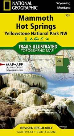


Yellowstone National Park NW: Mammoth Hot Springs Topographic Map
Tech Specs
Las especificaciones se mantienen en Pack4Back GearDB (edición comunitaria e historial). Pueden diferir del fabricante o de tu unidad.
BrandNational Geographic
Best UseHiking
State / ProvinceWyoming
Folded Dimensions19.1 × 10.2 cm
Unfolded Dimensions95.9 × 64.8 cm
Map Scale1:70,000
Double SidedYes
WaterproofYes
PublisherNational Geographic
Copyright Year2019
Map Number303
Description
Offering comprehensive coverage for outdoor enthusiasts, the Trails Illustrated Yellowstone National Park NW: Mammoth Hot Springs topographic map provides excellent detail of this striking region.
Datos clave
- Expertly researched and created in partnership with local land management agencies
- Key points include Mammoth Hot Springs area, Canyon Village, South Entrance Station, West Yellowstone, Upper Yellowstone Falls and Lower Falls of the Yellowstone River
- Also includes Gallatin National Forest, Absaroka-Beartooth Wilderness, Lee Metcalf Wilderness, Crowfoot Ridge, Grouse Mountain, Mount Holmes and Ramshorn Peak
- Precisely mapped trails with mileage markers and and marked Bear Management Zones help you get off the beaten path and back again
- To aid navigation, the map includes contour lines, elevations, summits, passes and many lakes
- Marked recreation features include visitor centers, campgrounds, trailheads, boat ramps and interpretive trails
- Every Trails Illustrated map is printed on "Backcountry Tough" waterproof, tear-resistant paper