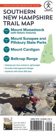
Southern New Hampshire Trail Map
Tech Specs
Les fiches techniques sont tenues sur Pack4Back GearDB (communauté et historique des versions). Des écarts avec le fabricant ou ton matériel sont possibles.
BrandAMC
Best UseHiking
Folded Dimensions22.9 × 10.2 × 0.4 cm
Unfolded DimensionsUnavailable
Map ScaleUnavailable
Double SidedYes
WaterproofYes
PublisherAppalachian Mountain Club Books
Copyright Year2020
State / ProvinceNew Hampshire
Description
Made to withstand many years of hard use on the trail, the Southern New Hampshire Trail Map from AMC is an indispensable resource for any hiker setting out in the southern half of the Granite State.
Points clés
- Covered areas include Mount Monadnock, Mount Sunapee and Pillsbury state parks, Mount Cardigan, and the Belknap Range
- Created using the latest GIS information, including cutting-edge LiDAR data, this fully updated map features trail-segment mileage and improved color coding
- An ideal upgrade to the paper maps that come with AMC's Southern New Hampshire Trail Guide, 5th Edition
- This full-color topographic map is printed on lightweight, waterproof, tear-resistant Tyvek
- ISBN-13: 9781628421163