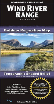
Wind River Range Outdoor Recreation Map
Tech Specs
Les fiches techniques sont tenues sur Pack4Back GearDB (communauté et historique des versions). Des écarts avec le fabricant ou ton matériel sont possibles.
BrandBeartooth Publishing
Best UseHiking
State / ProvinceWyoming
Folded Dimensions20.3 × 10.7 cm
Unfolded Dimensions99.6 × 64.0 cm
Map Scale1:100,000
WaterproofYes
PublisherBeartooth Publishing
Copyright Year2020
Description
One of the most famous mountain ranges in the U.S., the Winds often defy reason with their beauty. Use this Beartooth Publishing Wind River Range recreation map to guide your explorations in Wyoming.
Points clés
- For decades, this range has been a destination for backpackers and rock climbers from around the world
- And even for car campers, you can't go wrong with the Winds; the map cover photo was taken from next to the Green River Lakes Campground
- Covers the towns of Lander, Pinedale and Dubois, and the Bridger, Fitzpatrick and Popo Agie wilderness areas
- All trailheads and access roads are shown to get your trip started