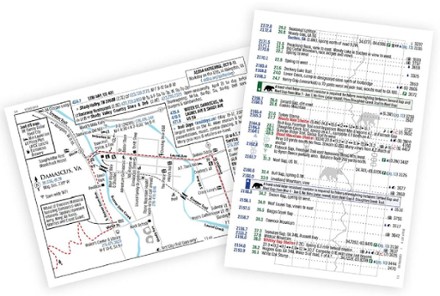


The A.T. Guide - 2023 Edition
Tech Specs
BrandAntiGravityGear
Best UseBackpacking
Dimensions7.5 x 5.5 inches
Author(s)David "AWOL" Miller and AntiGravityGear
Number of Pages240
FormatPaperback
ISBN-139781736087732
PublisherAntiGravityGear, LLC
Copyright Year2023
Description
Updated for 2023, the A.T. Guide is great for hikes of any length on the Appalachian Trail. Use this handy guide to know where you are on the trail and what views, streams and campsites lie ahead.
Features
- Includes 99 maps for towns, areas and difficult trail intersections, including services and GPS coordinates
- Contains thousands of landmarks such as identified campsites or tent sites, water sources, summits, gaps, shuttle services and shelters, including distances to and from others
- 2,620 mile to trail landmarks have point-by-point cumulative mileage (both NoBo and SoBo)
- Elevation profile is included and every landmark is aligned to the profile
- Includes 922 services listings (listed in order of distance from the trail), including lodging services, resupply points, parking areas and post offices
- Includes important information from state parks and trail maintaining clubs as well as safety and best practices information
- 47 custom icons for identification of services at a glance
- Flora and fauna information is embedded directly into trail data where you may be encountering it on trail
- Printed in color with a laminated cover to withstand the rigors of trail use
- Includes a plastic seal-top bag